Bonchurch Landslip
Bonchurch Landslip is currently closed due to a major landslip. Access is not permitted and it is unlikely that this site will open in the near future. Until a decision is made we will maintain this page as an archive of its former glory.
Once the site is considered stable, we will be working with the site owners, Isle of Wight Council, to determine its future as a nature site.
To see the current state of the slip (February 2024) click here for a super film.
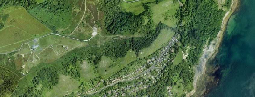
Bonchurch landslip is a large area of woods and jumbled paths between Luccombe and Bonchurch villages. It features some remarkable landforms, cliffs, boulders and steep steps, and is one of the most extraordinary landscapes on the Island which has been delighting and intriguing visitors for over 200 years.
The coastal path runs through the reserve, and walkers can climb up the inner cliff through the bizarre and claustrophobic climbs of The Devil’s Chimney or The Chink.
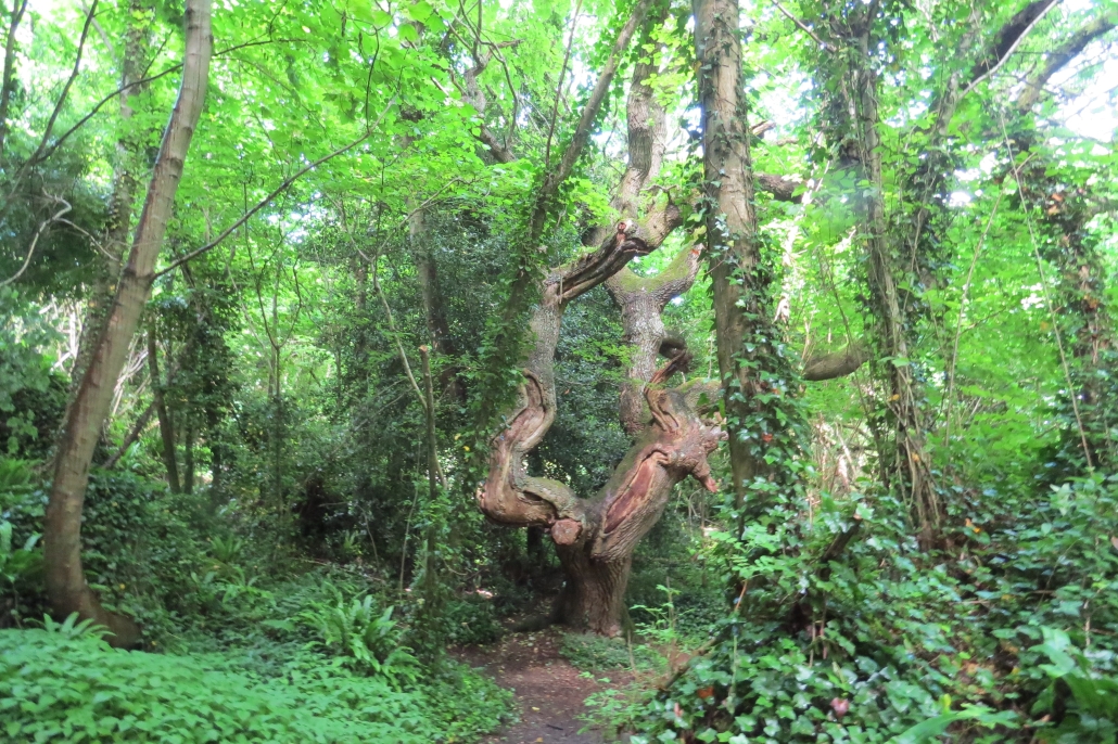
The landslip has an established woodland of ash, oak and beech, with unusual lichen species. The lower slips, comprising mixed clay and sandy habitats, once supported a complex mix of acid-loving and chalk-loving plant species, but much of this has fallen into the sea, and the lower area is almost impossible to get to because of the continued land movement.
Find out more about the history of the site here.
What to look and listen for…
Find the Devils Chimney, The Chink and the Wishing Seat. In places there are spectacular views of the English Channel. This site was once a pleasure garden and you can spot remains of path and path edging, but there are also natural rock formations – particularly in the lower part of the site. Many of the paths are sunken, so you will be eye level with tree roots given the appearance of fairy hollows. For botanists, there are rare bryophytes and lichens.
Throughout the site there are a variety of trees, and particularly in the lower part of the site there are some grand old oak trees. The site is s so steep it is very difficult for us to remove fallen trees, so we leave then safely down there, and they form excellent habitats.
Listen to the waves, and the wind in the trees. The bird song is best in the upper part of the site.
… and smell and touch
Sniff Stinking Iris – otherwise known as ‘Roast Beef Plant’.
Feel the warmth of the microclimate of the Undercliff and contrast with the cool damp rocks – you can touch the rockface in the lower part of the site, where you can also sit on the Wishing Seat and make a wish. Collect the different leaves and seeds from the many different trees, and feel the shiny leaves of Hart’s Tongue Fern, it’s all over the site. This contrast with the sharp leaves of Holly and Butcher’s Broom.
Nature at home and activities on site
We have produced a super Colouring Sheet for you to download and complete at home. We have also produced an I Spy Sheet and Map for you to print at home or download to your phone and take to the site. And become a Bug Bunch Ranger. All these activities and resources can be found here.
Managing the site
This is a very steep site and the land is slipping. This stresses the trees and makes them prone to disease. Therefore we occasionally need to take down a tree. It’s not very easy to extract the trees, so we will leave on site to create dead wood habitats piles.
How to get there
There is no access by footpaths or roads. There is a road closure to the north from Shanklin and southwards at the junction of Leeson Road and Bonchurch Shute. There is no access to the site car park from either direction. All footpaths in the vicinity are closed. Full details of footpath closures can be found here.
Get Involved
There are various ways you can help improve and maintain our sites. We rely on volunteers to help with many tasks on our sites and also need people who are happy to regular visit the site be our “eyes and ears”, this means we can respond much quicker to issues. Our shop raises money to support our work and needs a team of volunteers. Or maybe you would like to help us with events. Find out more here.
You can also help by becoming one of our regular supporters. Even giving a few pounds each month can make a real difference, with your donation being invested into site management and improvement work to benefit site visitors and look after our precious wildlife. Sign up here.
